Iqaluit mapping expedition sees Google staff hike along remote city's snow-covered trails and risk wrath of polar bears
By Allan Woods
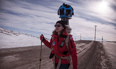
Now, however, the search-engine firm is embarking on what might be the most significant update to centuries of polar cartography–and one it hopes will foster a better understanding of life on the permafrost for millions of web users. Google has flown a small team to Iqaluit, the largest town in the Canadian territory of Nunavut, armed with their warmest winter gear, a stack of laptop computers and a 18kg (40lb) backpack-mounted telescopic camera.
Helped by an Inuit mapping expert, and stalked by curious locals, the team spent four days trudging through the terrain and collecting the images and information that will give the isolated community on the tundra of Baffin Island what urbanites across the globe now take for granted.
The town of 7,000 people will go on display via Google's popular Street View application in July.
Below: "Google Street View's Karin Tuxen-Bettman treks across the Arctic tundra in Iqaluit."
1 comment:
Indians have actually been employing Google Earth for a lot of things. In the Amazon, they're using satellite technology to spot trespassers.
Post a Comment